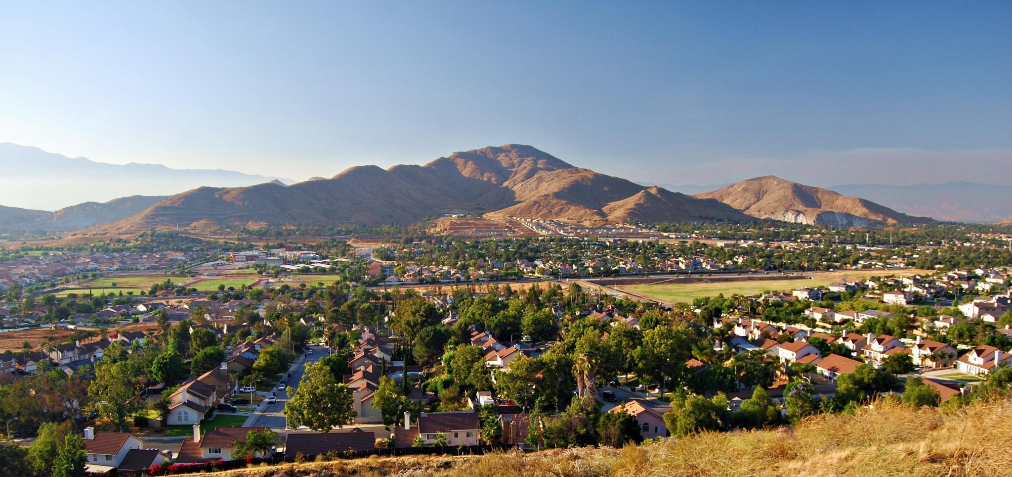
Outdoors
Fishing near Jurupa Valley
Lakes, rivers and recreation areas near Jurupa Valley where fishing is allowed, closest first.
11places to fish
14 mito the closest
10within 30 miles
Good to know: Anyone 16 or older generally needs a state fishing license; seasons, limits and special rules vary by water. California license information ↗
Closest picks
Carbon Canyon Dam
21 mi west · US Army Corps of Engineers
Managed by Orange County, there is no permanent pool, but varied facilities such as fishing, picnic areas, a nature trail, and tennis. The site of the historic oil boom town of Olinda. Adjoins Chino Hills State Park.
Dogwood
22 mi northeast · USDA Forest Service
Dogwood Campground is a family-friendly facility located in the heart of the San Bernardino National Forest. All sites must be reserved to enjoy the area's scenic surroundings and plentiful recreational opportunities.
Map of all 11 places
Map of 11 places loads as you scroll.
Within 30 miles (10)
San Bernardino National Forest
- Biking
- Camping
- Climbing
- Fishing
- Hiking
- Horse Camping
- Horseback riding
- Hunting
Carbon Canyon Dam
Managed by Orange County, there is no permanent pool, but varied facilities such as fishing, picnic areas, a nature trail, and tennis. The site of the historic oil boom town of Olinda. Adjoins Chino Hills State Park.
- Fishing
- Hiking
- Picnicking
- Wildlife viewing
Dogwood
Dogwood Campground is a family-friendly facility located in the heart of the San Bernardino National Forest. All sites must be reserved to enjoy the area's scenic surroundings and plentiful recreational opportunities.
- Boating
- Camping
- Fishing
North Shore (Ca)
North Shore Campground is a quiet place to camp, away from the hustle and bustle of nearby cities.
- Boating
- Camping
- Fishing
- Hiking
Fishermans Group
This campground is Hike In only. Fisherman's Group Campground is a semi-primitive campground reached by a 2.5-mile hike into the mountains of southern California.
- Camping
- Fishing
- Hiking
- Horseback riding
- Hunting
- Wildlife viewing
Tent Peg Group
Tent Peg Group Campground offers a semi-primitive location for an extended family or large group outing. The area provides easy access to many off-road vehicle trails.
- Biking
- Boating
- Camping
- Fishing
- Hiking
- Swimming
- Wildlife viewing
- Winter sports
Crab Flats
Crab Flats Campground is an off-roaders paradise, with plenty of off-road vehicle trails nearby for both beginner and experienced riders.
- Biking
- Boating
- Camping
- Fishing
- Hiking
- Swimming
- Wildlife viewing
- Winter sports
Green Valley
Green Valley Campground is located near Arrowbear in the San Bernardino National Forest in Southern California.
- Boating
- Camping
- Fishing
- Hiking
- Swimming
Santa Fe Dam
Facilities at Santa Fe are operated by Los Angeles County Parks. Swimming, fishing, non-power boating, hiking and picnicking are available. Of interest are the five distinct biological communities within the area.
- Boating
- Fishing
- Picnicking
- Water sports
- Wildlife viewing
Shady Cove Group Campground
Shady Cove Group Campground is a beautiful place to camp within the Children's National Forest. It provides access to numerous trails and a lookout tower, with a climbing area nearby.
- Biking
- Camping
- Fishing
- Hiking
- Ranger programs
- Wildlife viewing
30 to 75 miles (1)
Sand to Snow National Monument
Remember your OUTDOOR ETHICS when enjoying your public lands. Please RECREATE RESPONSIBLY.
- Accessible Swimming
- Camping
- Fishing
- Hiking
- Horseback riding
- Photography
- Wildlife viewing
- Winter sports
Distances are straight-line miles from downtown Jurupa Valley. Listings come from Recreation.gov’s federal recreation database; check each official page for hours, fees, fire restrictions and closures before you go.
Get outside around Jurupa Valley
THINGS TO DO · YOUTUBE SHORT
#shorts Jurupa Discovery Center
A local activity Short shared by Abel Ortiz.
Watch on YouTube ↗
THINGS TO DO · YOUTUBE SHORT
Hidden Gem: Mount Jurupa, California
A local activity Short shared by The Blank Canvas.
Watch on YouTube ↗Around Jurupa Valley


More outdoors near Jurupa Valley
- Hiking near Jurupa Valley
- Camping near Jurupa Valley
- Boating and kayaking near Jurupa Valley
- Biking and mountain biking near Jurupa Valley
- Picnic spots near Jurupa Valley
- Horseback riding near Jurupa Valley
- Wildlife viewing and birding near Jurupa Valley
- Swimming holes and lakes near Jurupa Valley
- Parks in Jurupa Valley
- Day trips
- Weather by month
Questions
Where is the closest place for fishing near Jurupa Valley?
San Bernardino National Forest (USDA Forest Service), about 14 miles northeast of Jurupa Valley as the crow flies. Next are Carbon Canyon Dam (21 mi) and Dogwood (22 mi).
Do I need a fishing license near Jurupa Valley?
Yes, anglers 16 and older generally need a California fishing license from the state wildlife agency. Rules, seasons and limits vary by water.
Who manages these places?
Federal agencies including USDA Forest Service, US Army Corps of Engineers, Bureau of Land Management. Each listing links to its official page for hours, fees, closures and current conditions.